‘Sites-and-services’ was an important housing paradigm that was mobilized in the context of development aid to provide cost-efficient housing for the global poor. It often operated on a large scale, and targeted thousands of households in a single project. Instead of proposing a complete design, this housing strategy aimed to guide future construction by providing ‘sites’ in combination with a wide range of ‘services’.
- {{ item.label }} {{ item.address }}
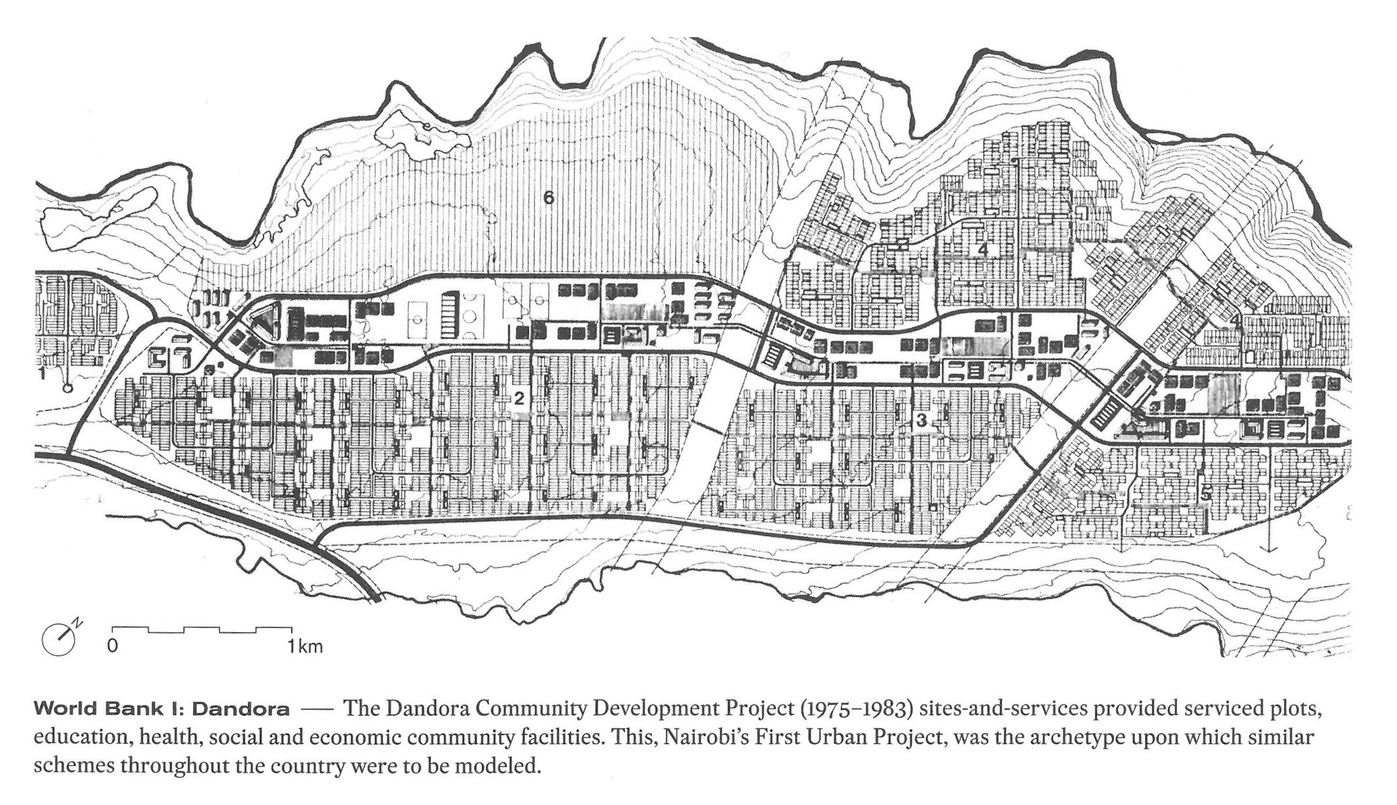
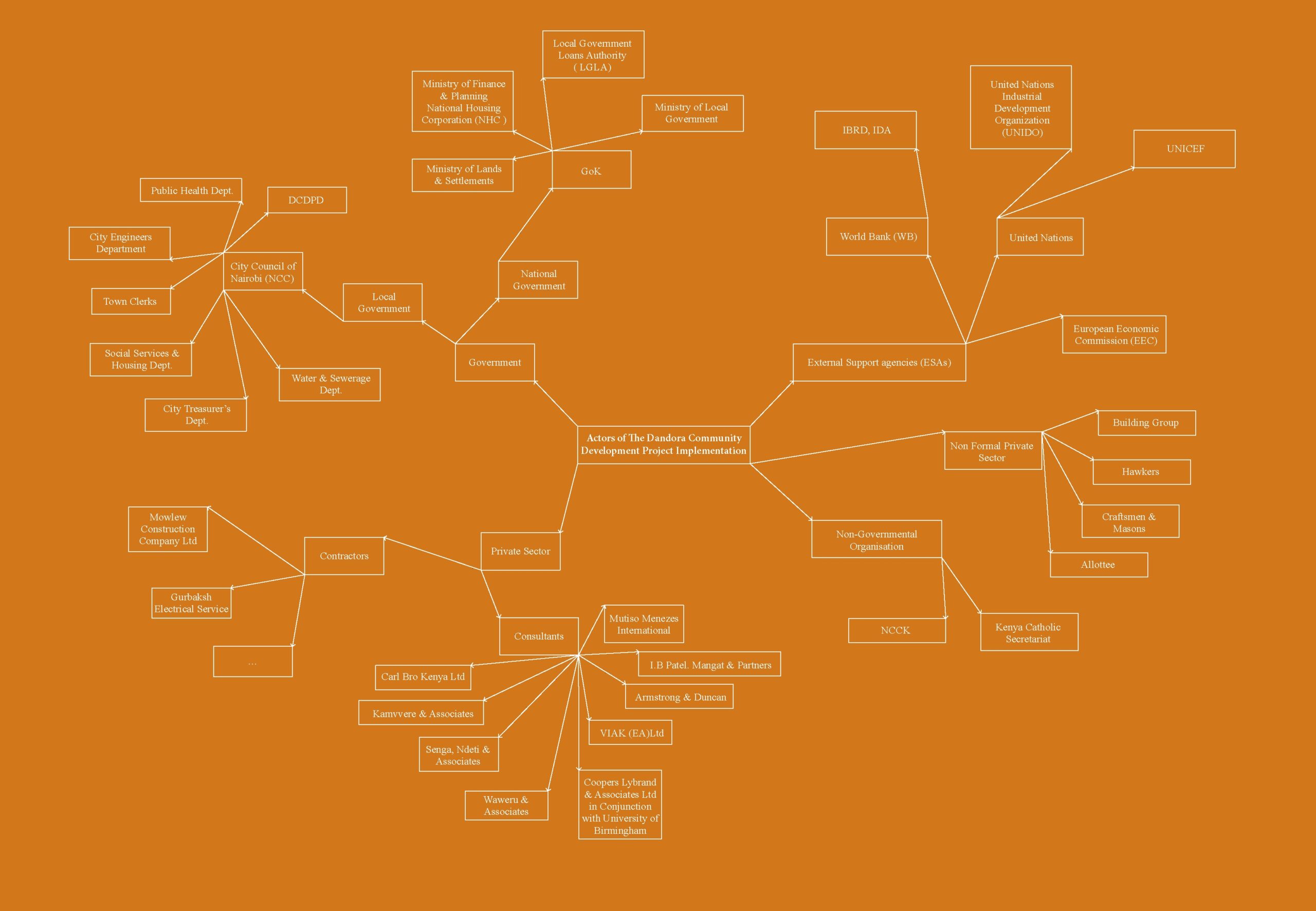
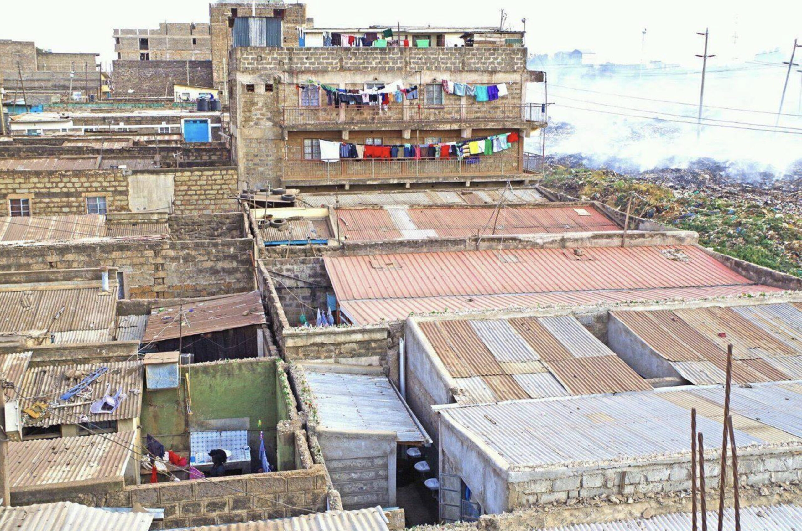
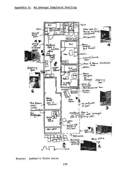
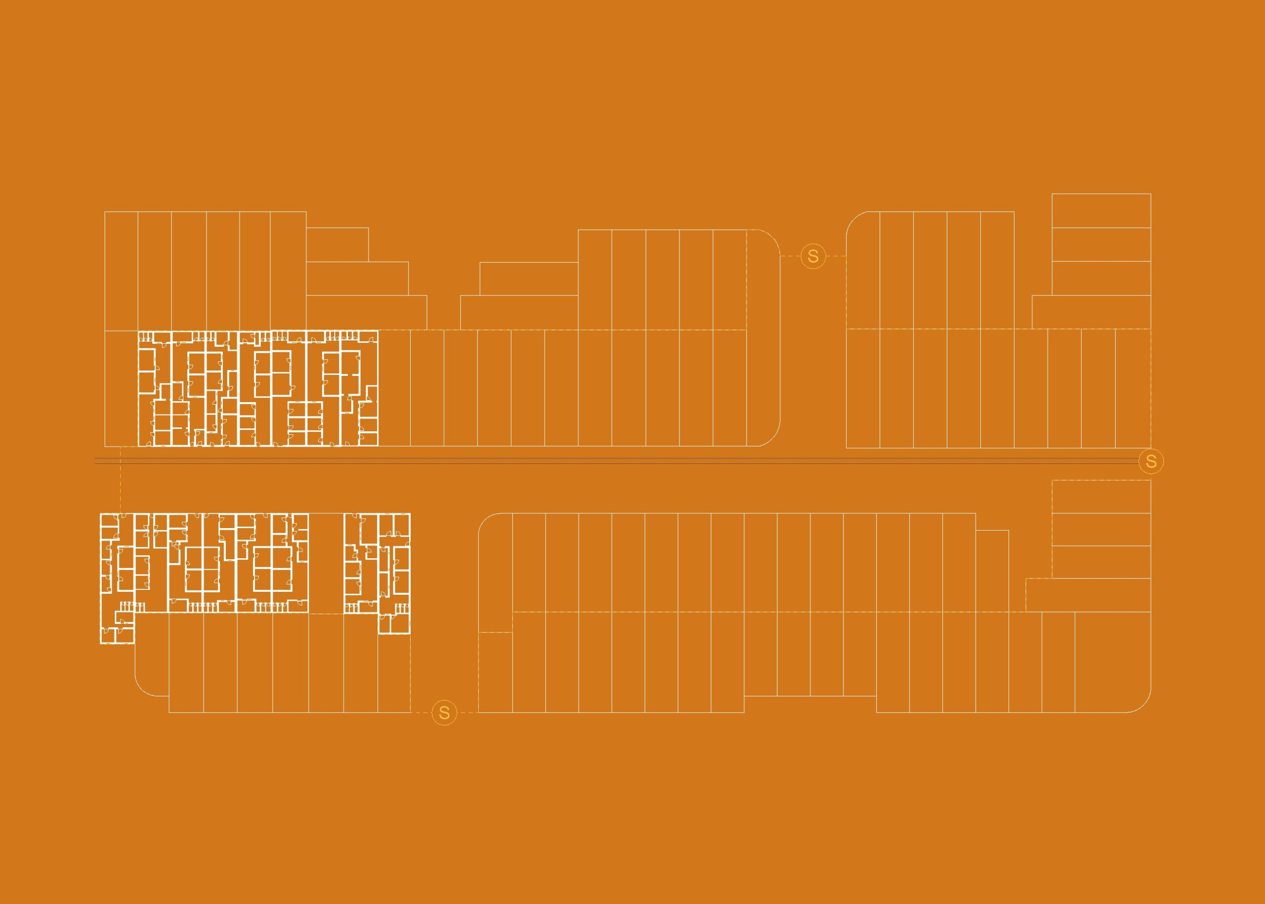
The Dandora Community Development Project
Nairobi, Kenya
1975-1983
by Pierre Eichmeyer, Leandra Graf, Julia Tanner
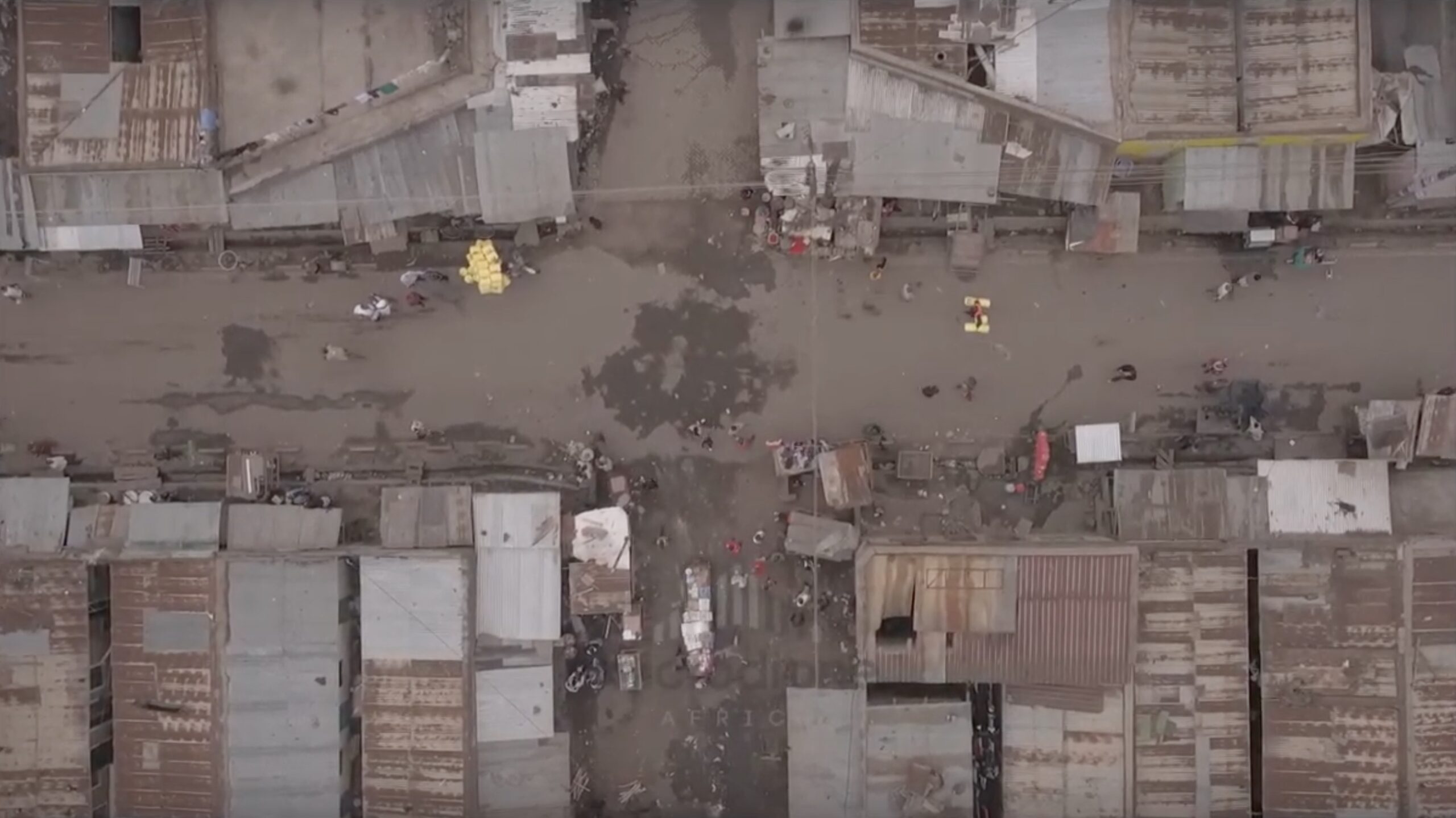
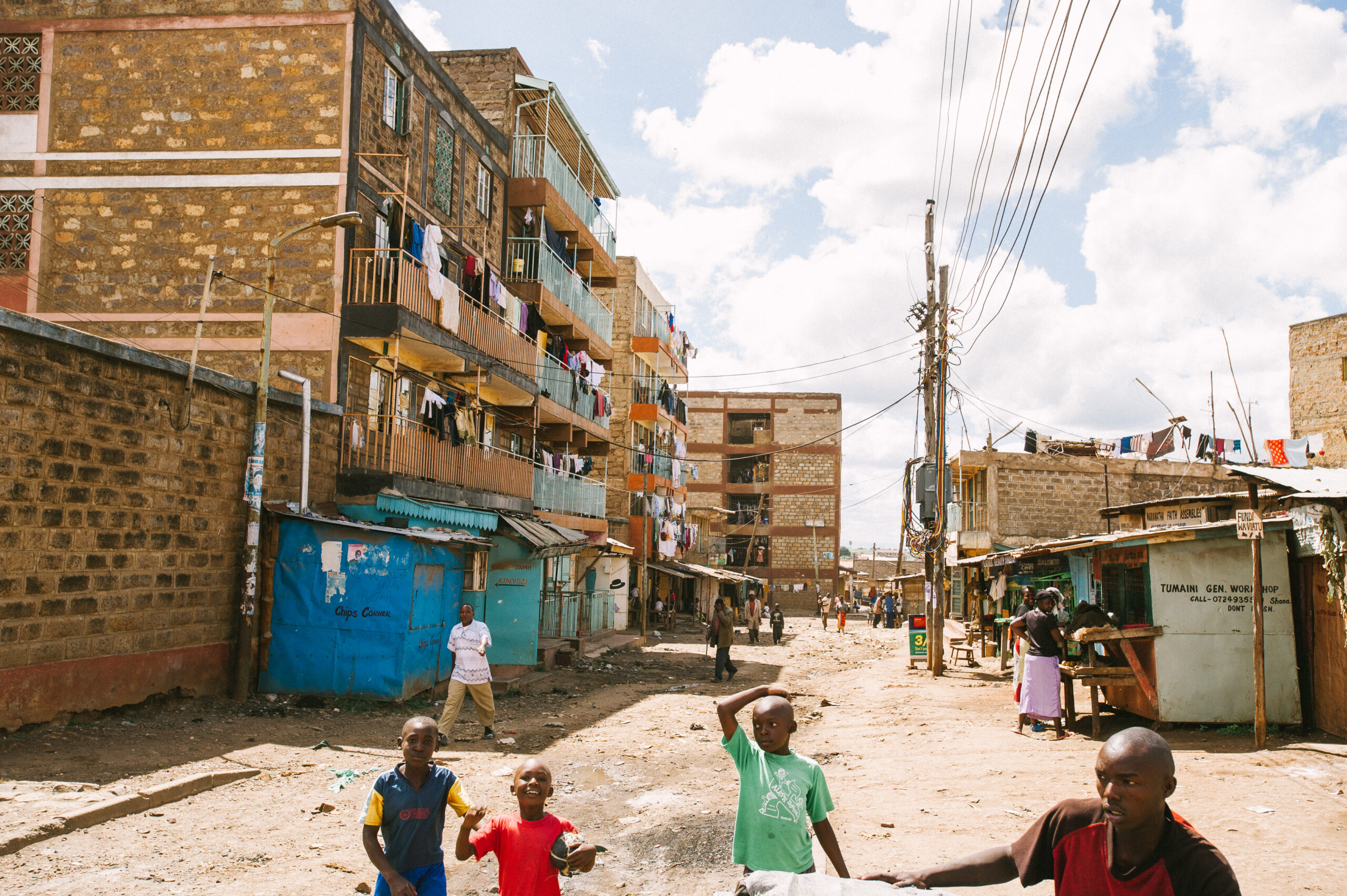
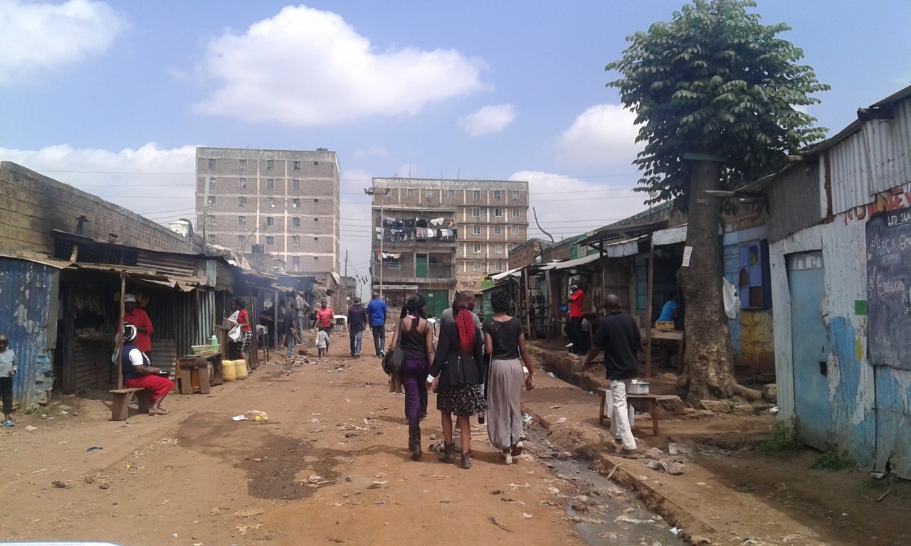
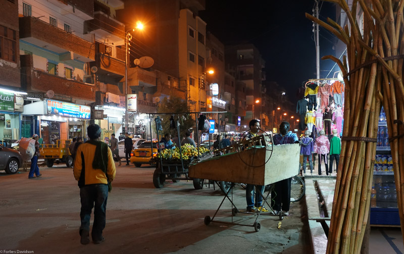
Informal Commercial Infrastructure
by Julia Tanner
Dandora at Night
by Leandra Graf
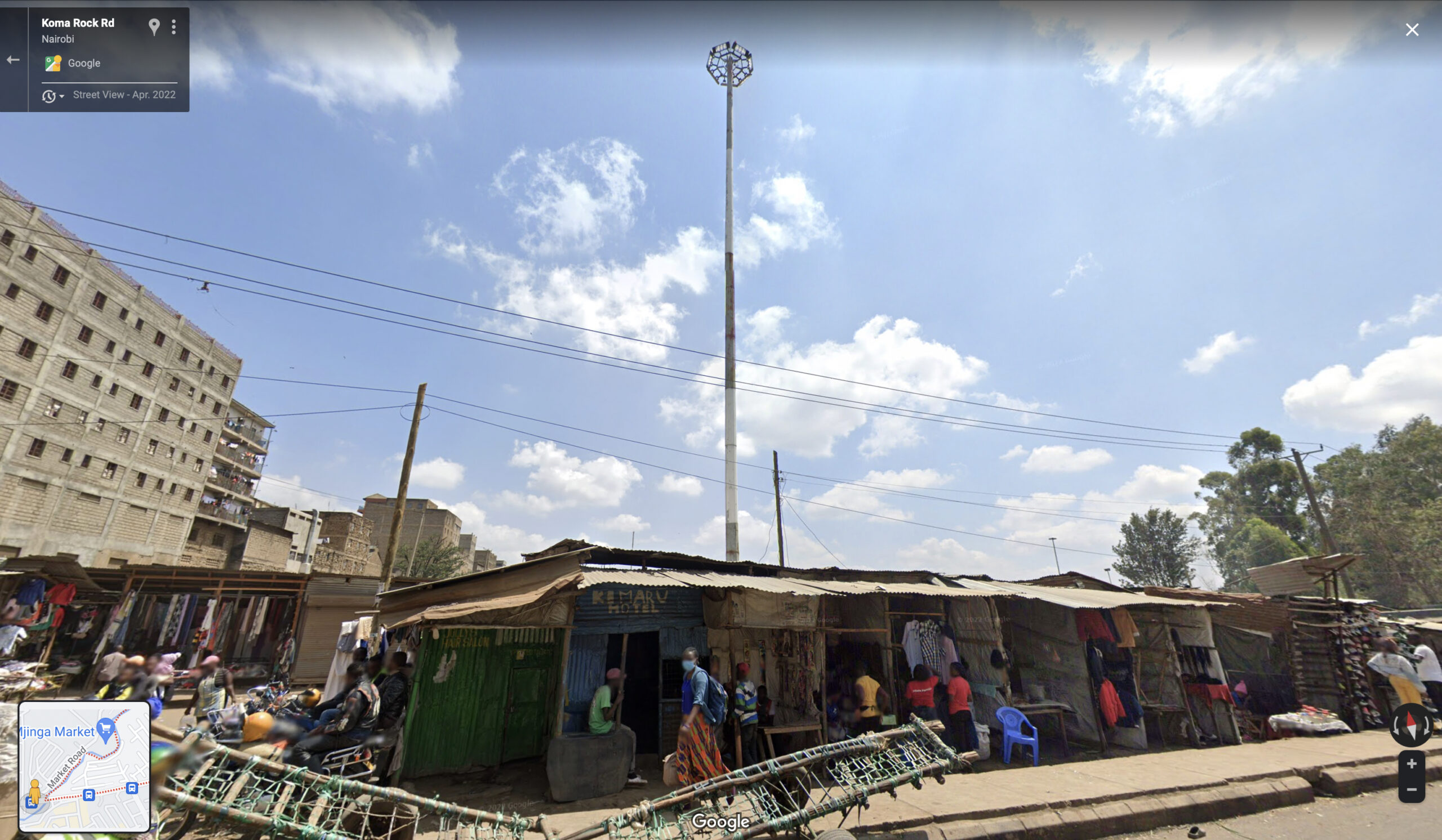

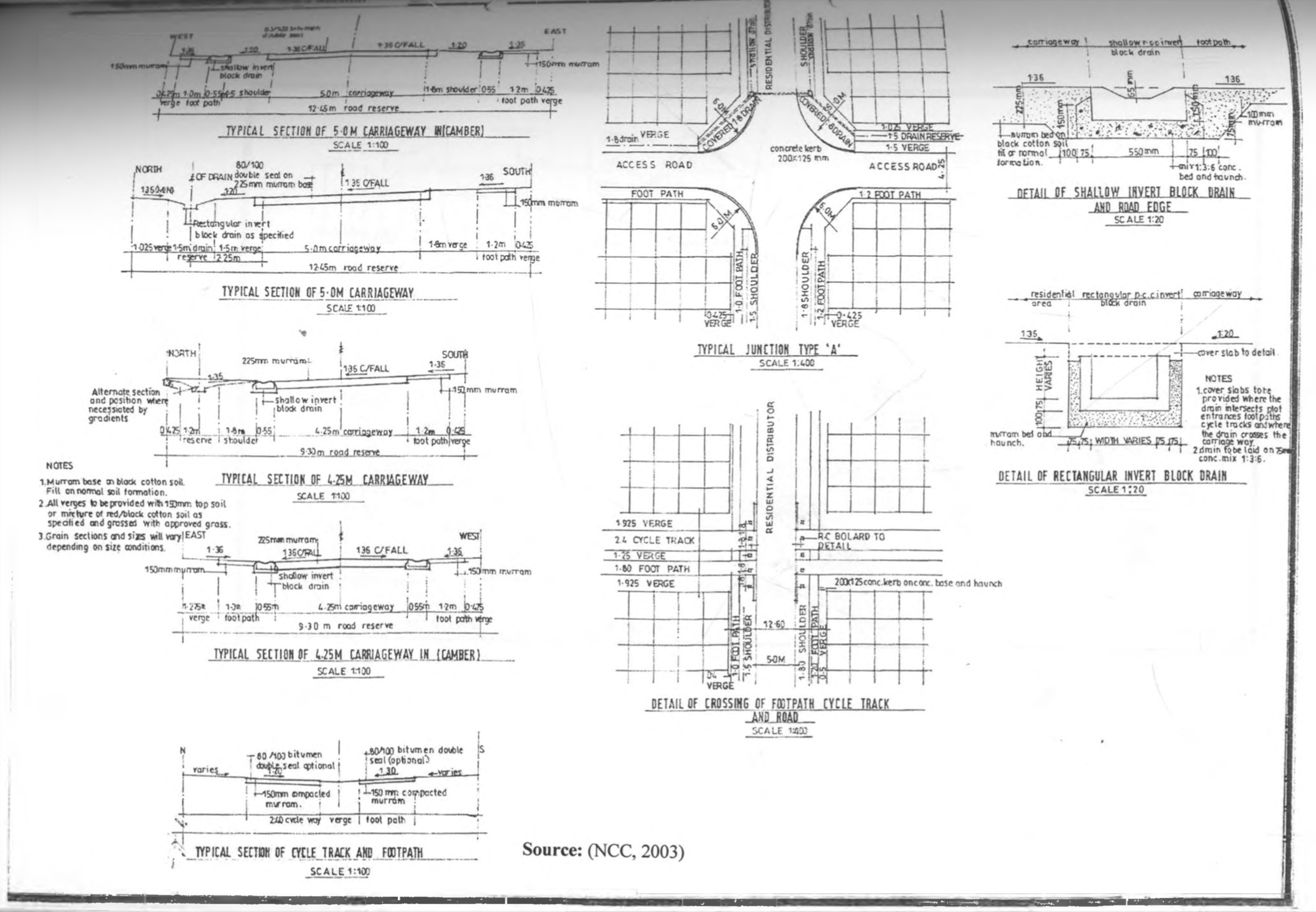
Roads in Dandora
by Pierre Eichmeyer

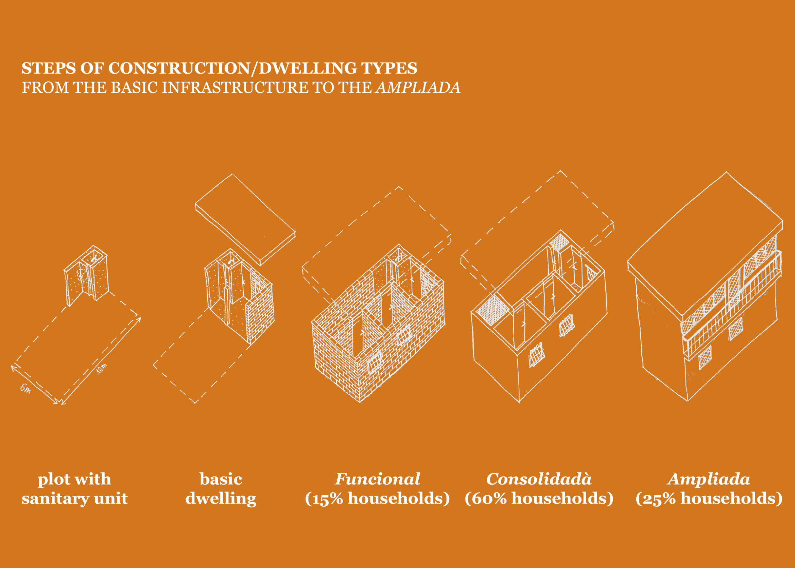
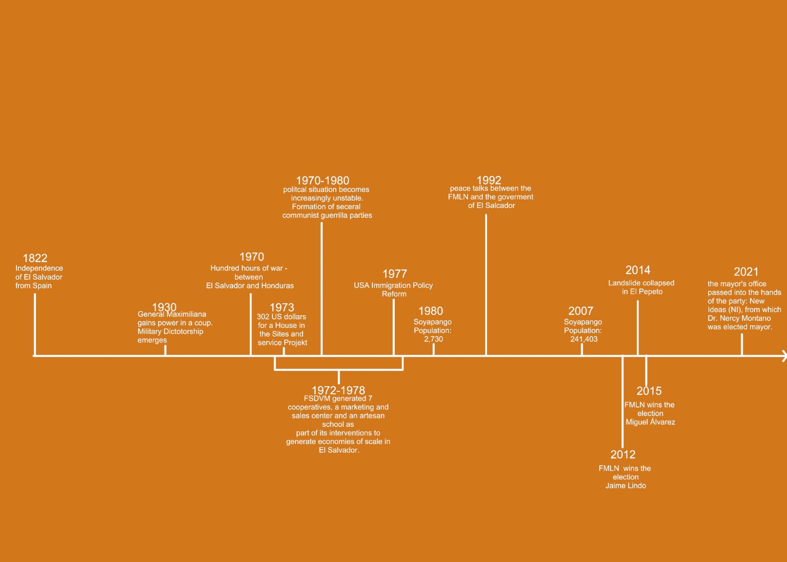
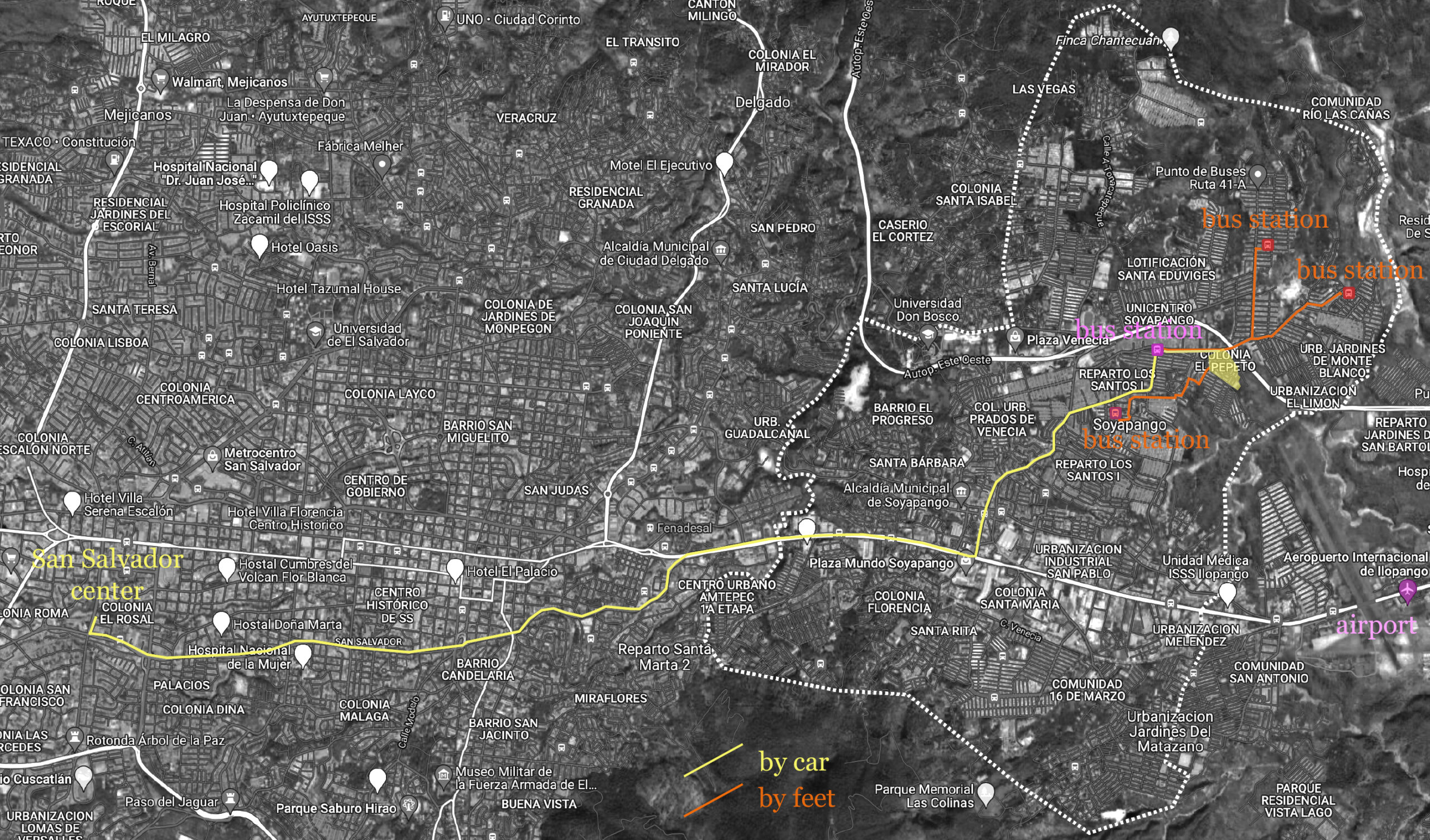
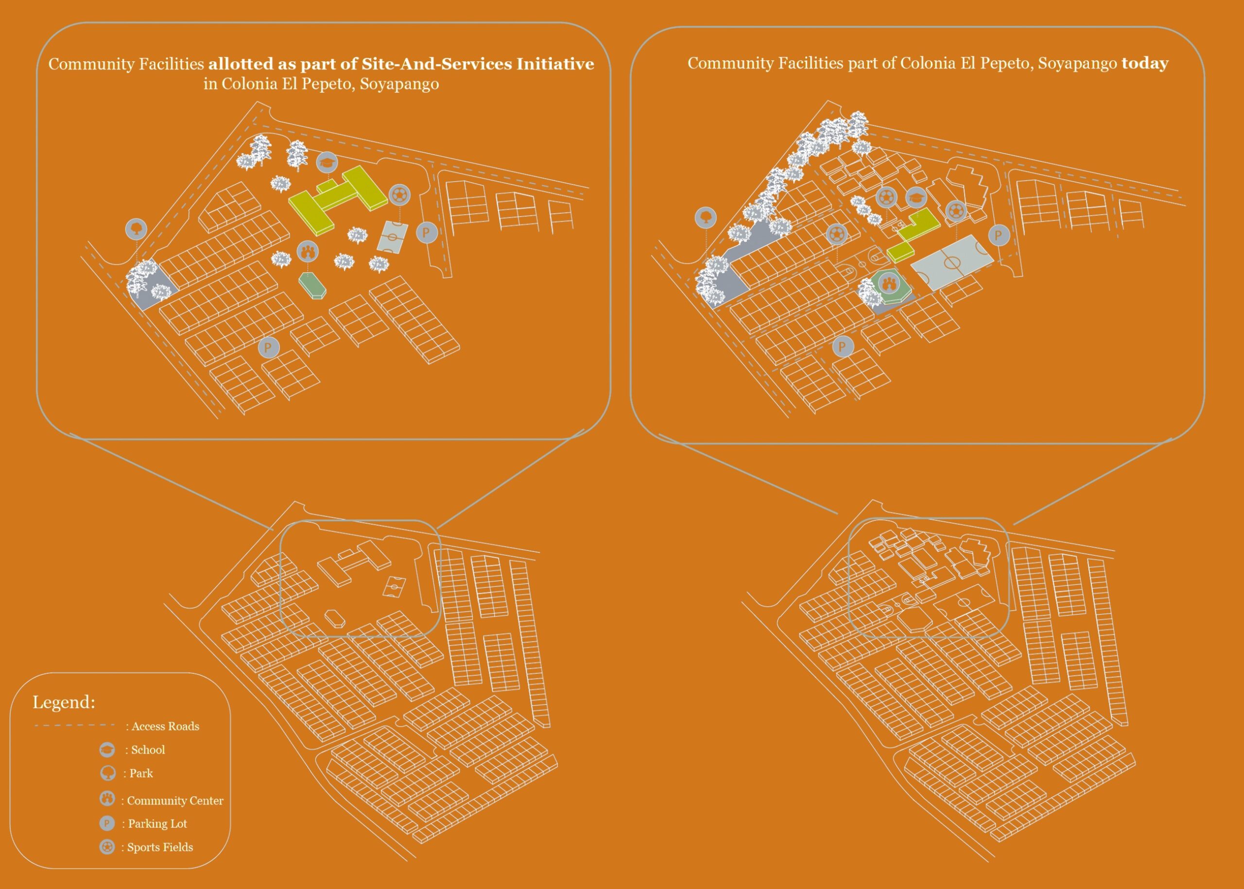
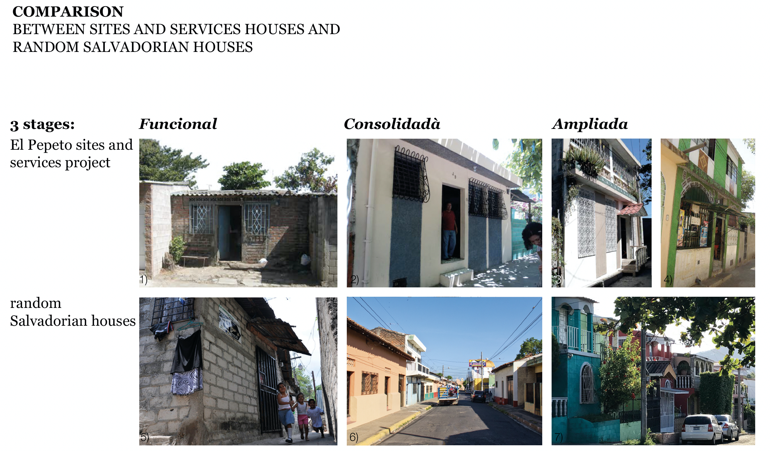
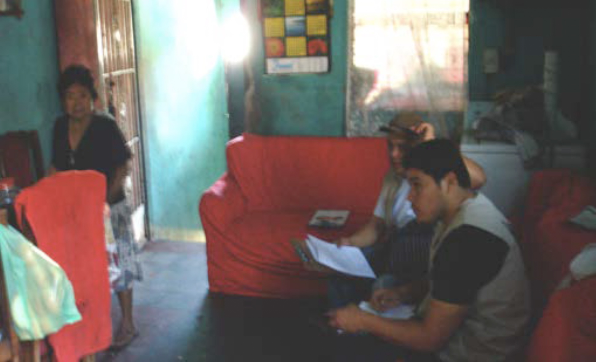
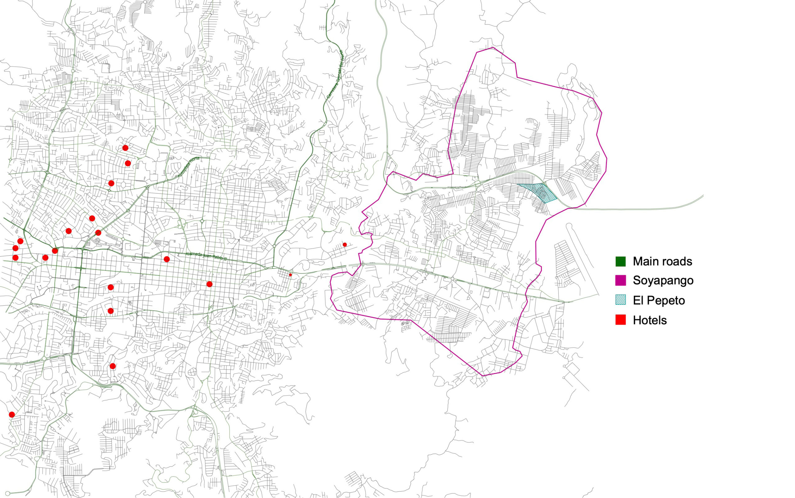
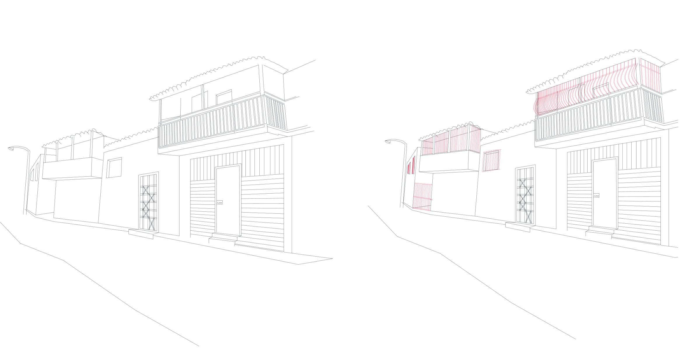
Colonia El Pepeto
Soyapango,
El Salvador
1974-1975
by Victor Kleyr, Amélie Lambert, Lars Ludes, Shreya Sen
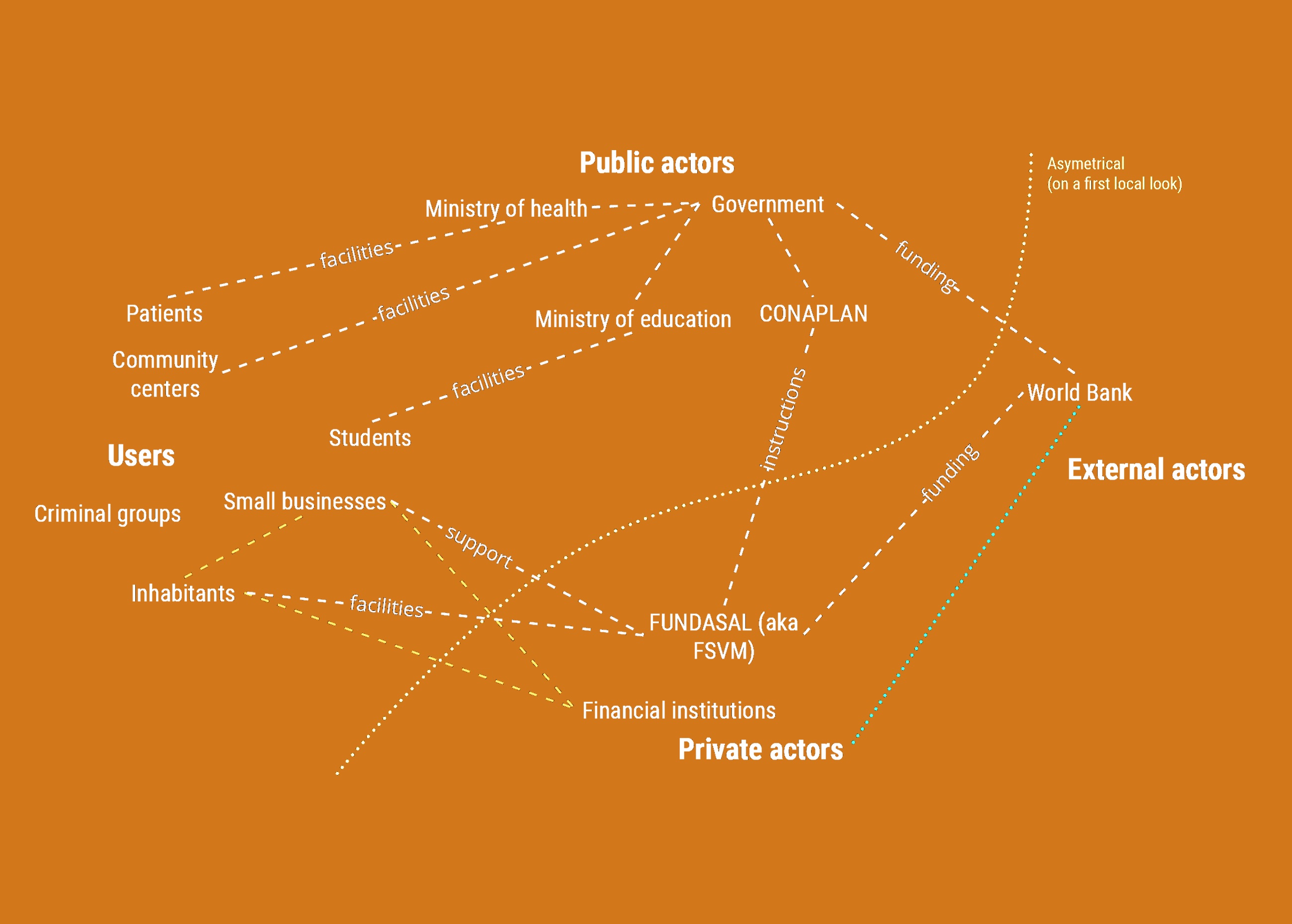
External Actors’ Influence
by Victor Kleyr

Appropriation of Private Space
by Amélie Lambert

The Influence of Gangs
by Lars Ludes


Community-Based Facilities & Programs
by Shreya Sen


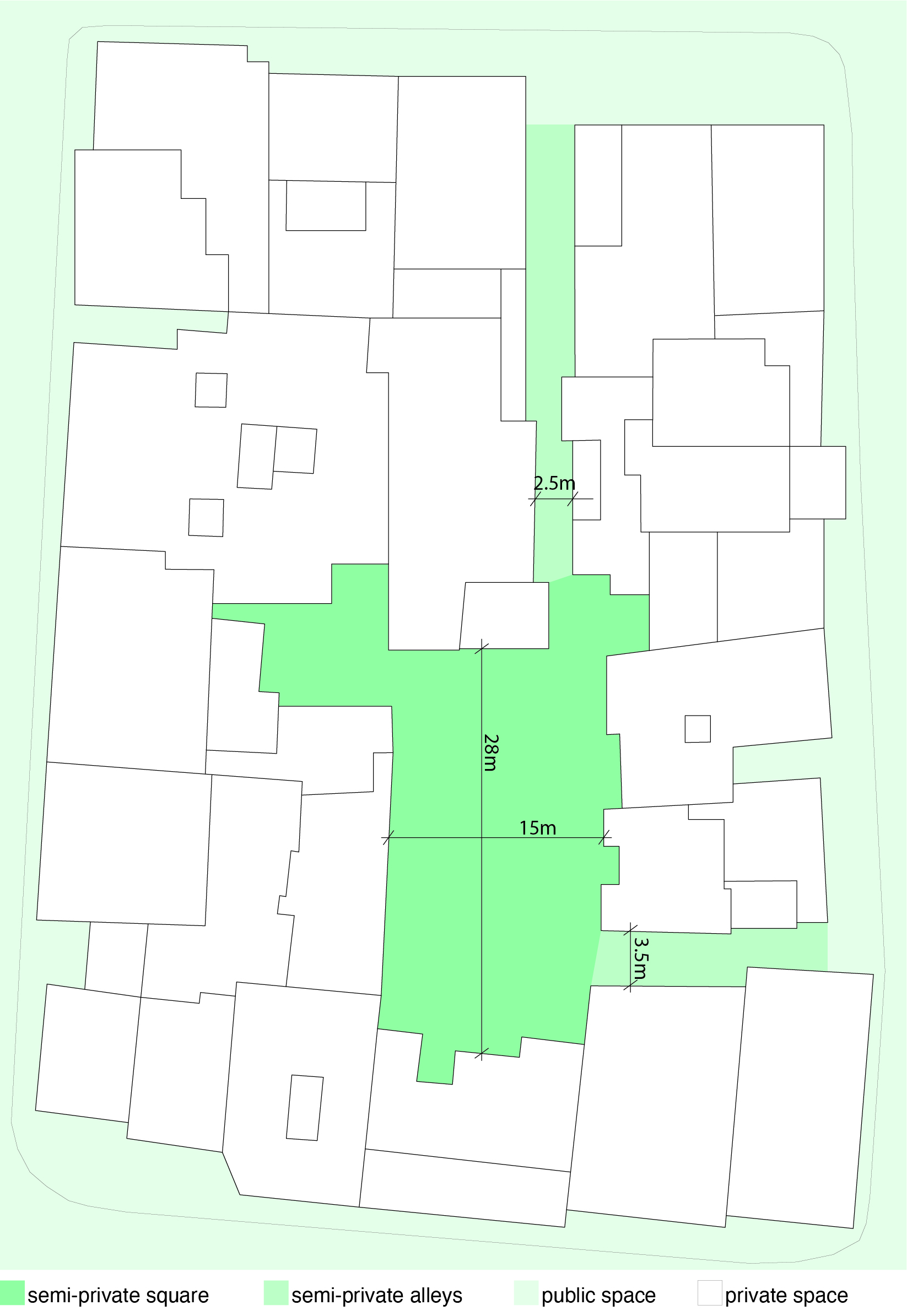
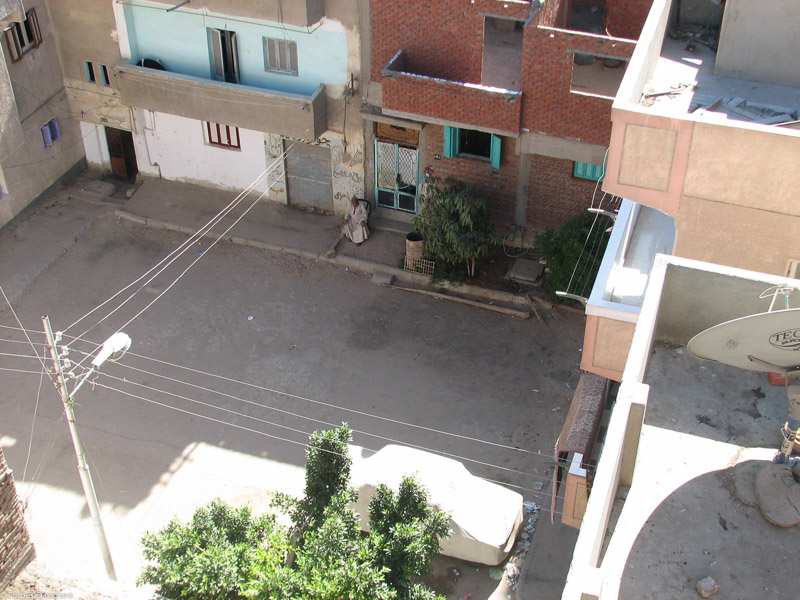
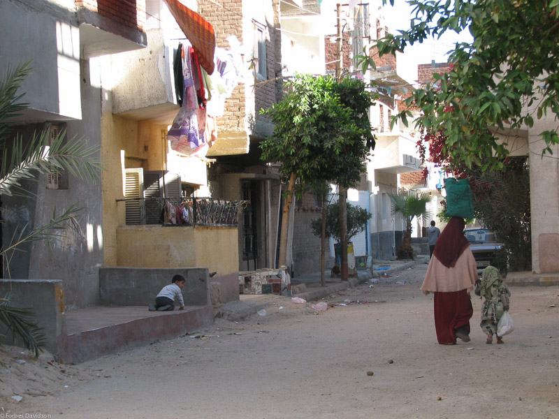
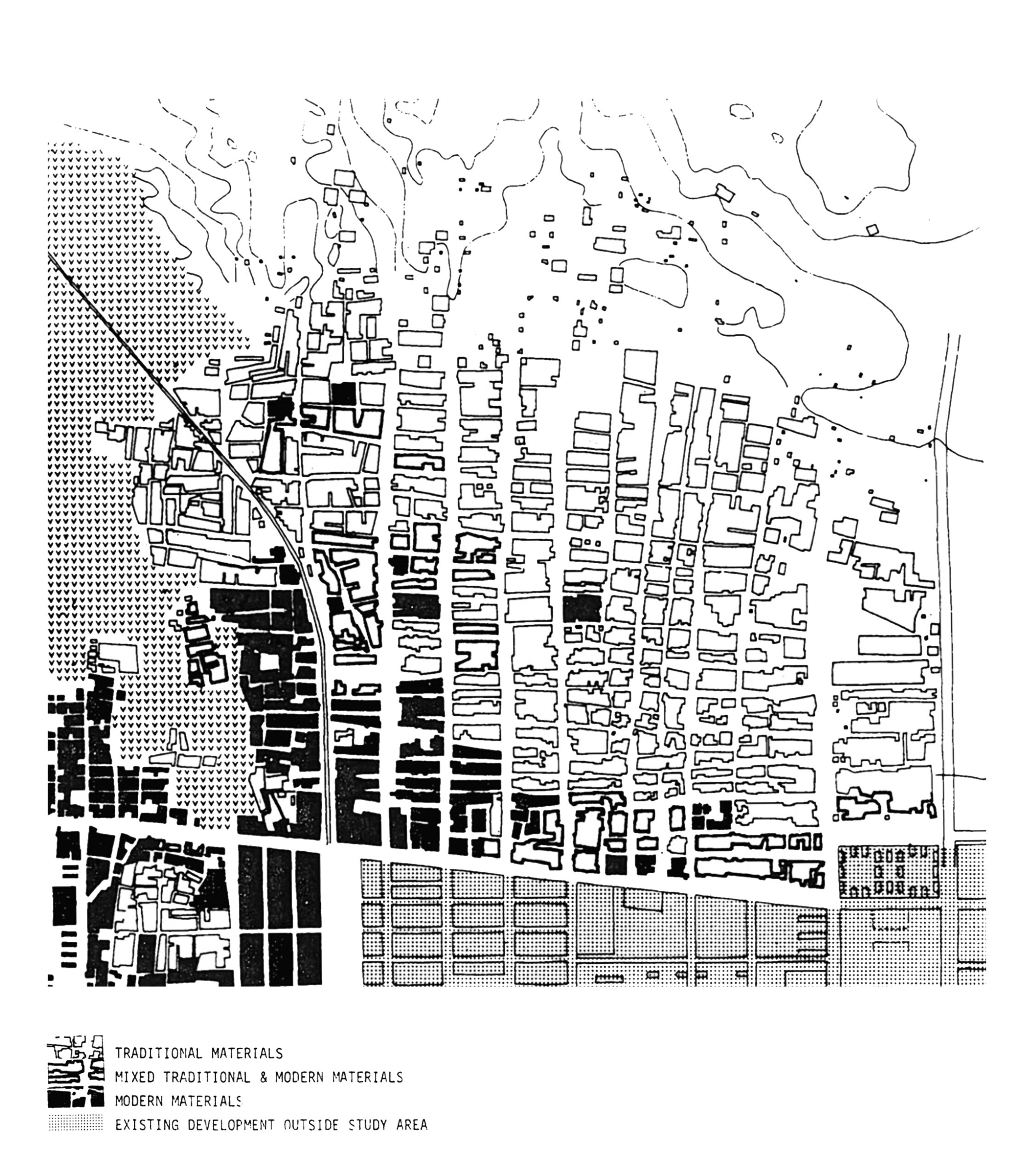
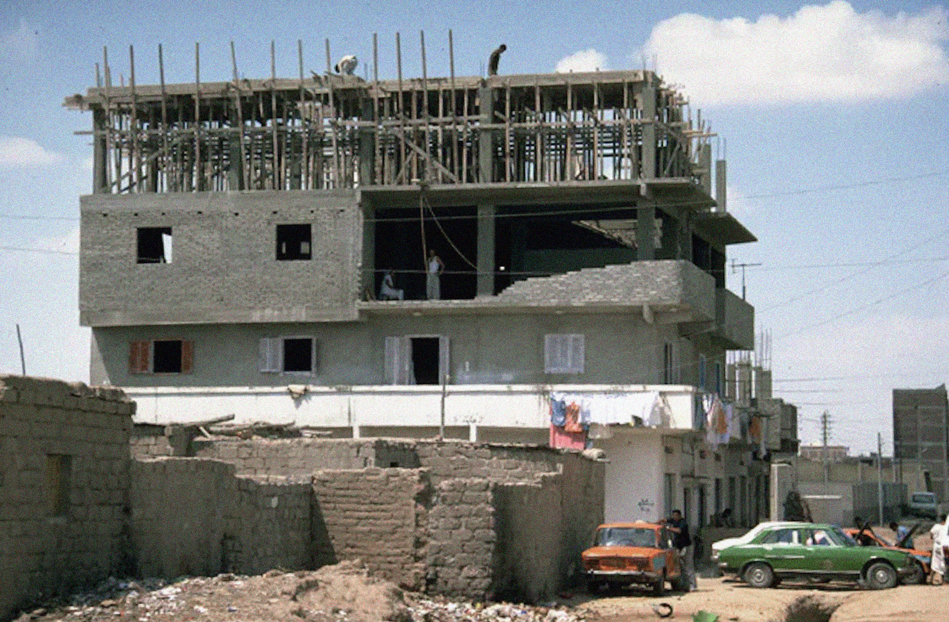
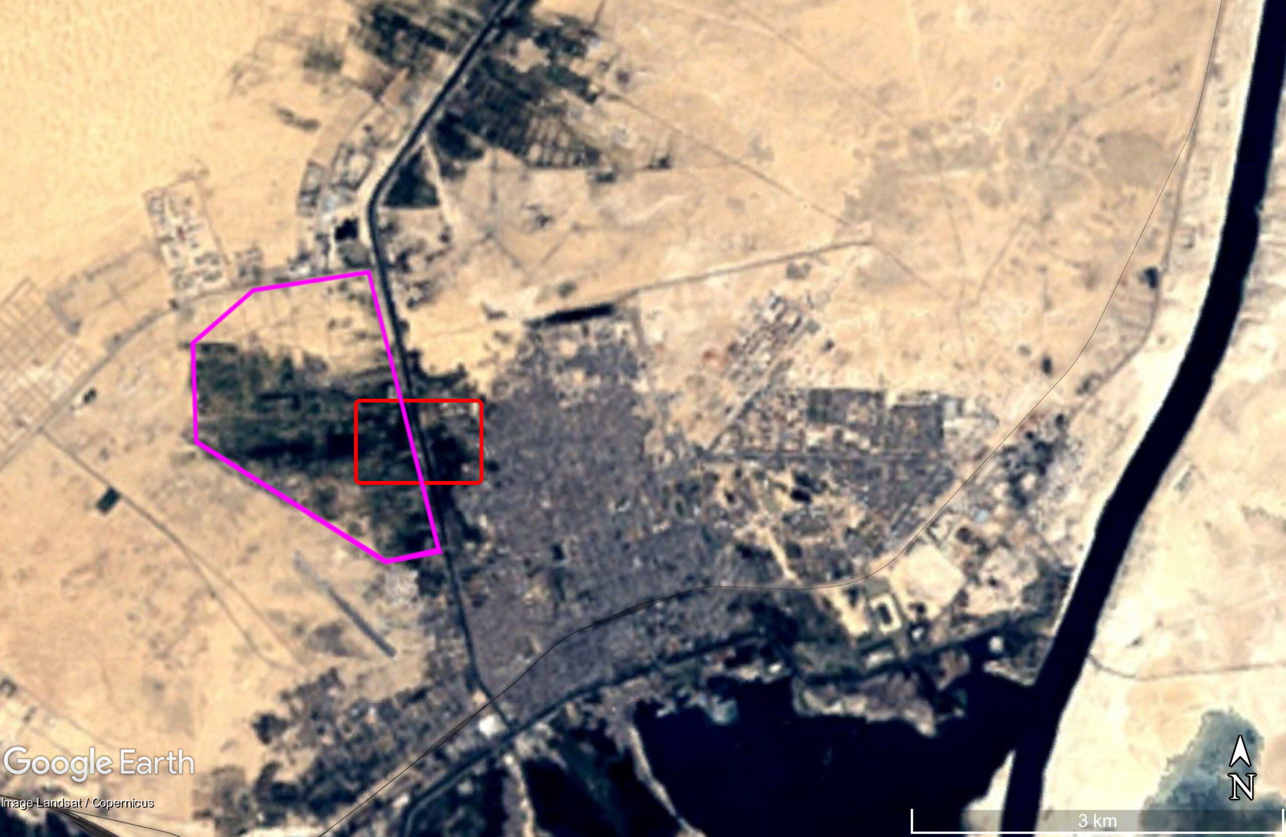
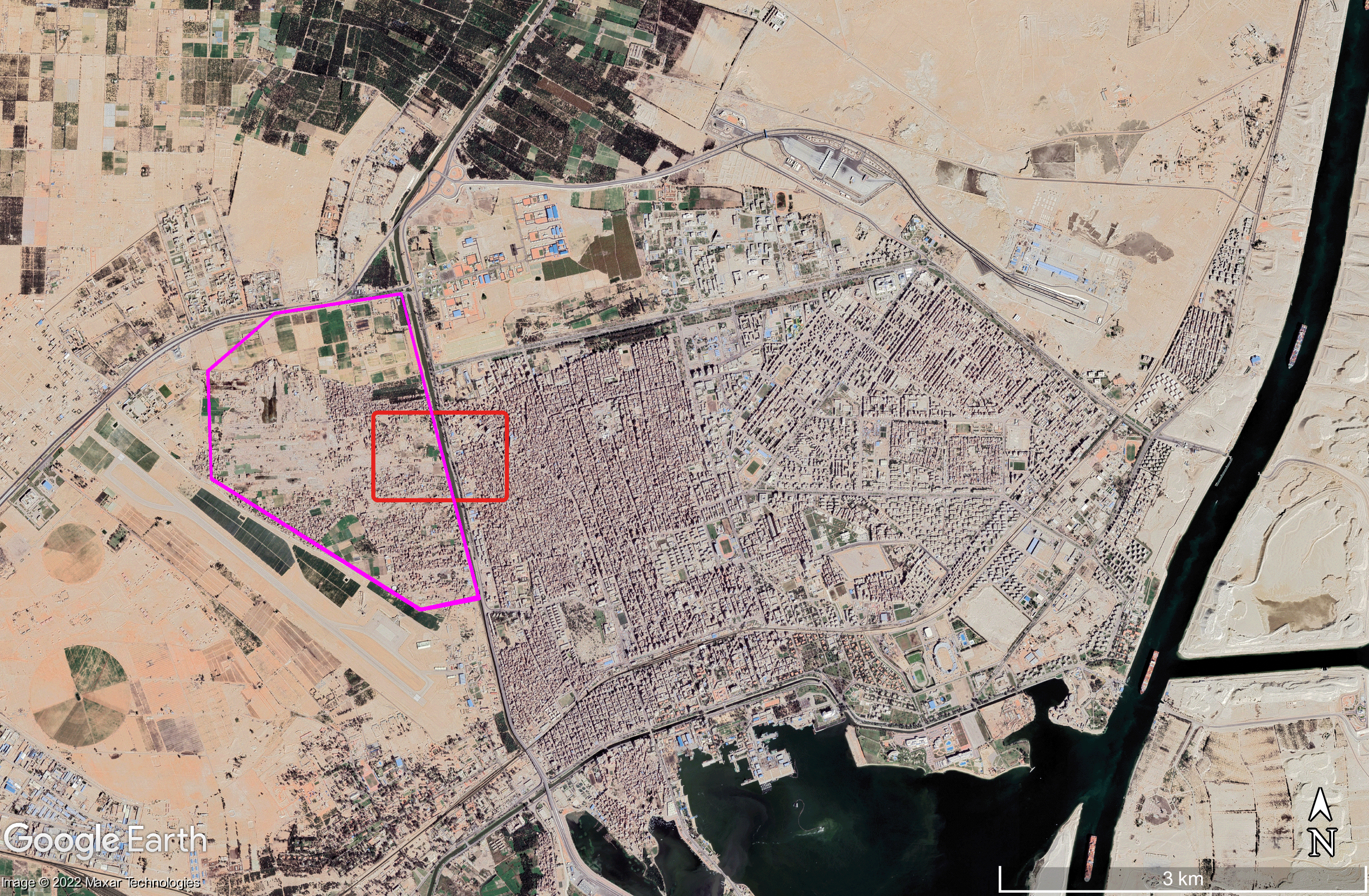
Hay El Salam
حيّ السلام
Ismailia, Egypt
1978-1982
by Léna Grossenbacher, Raúl Hansra Sartorius, Clara Zuber


Materials and Social Injustice
by Léna Grossenbacher

Beyond the Fields Lived
by Raúl Hansra Sartorius
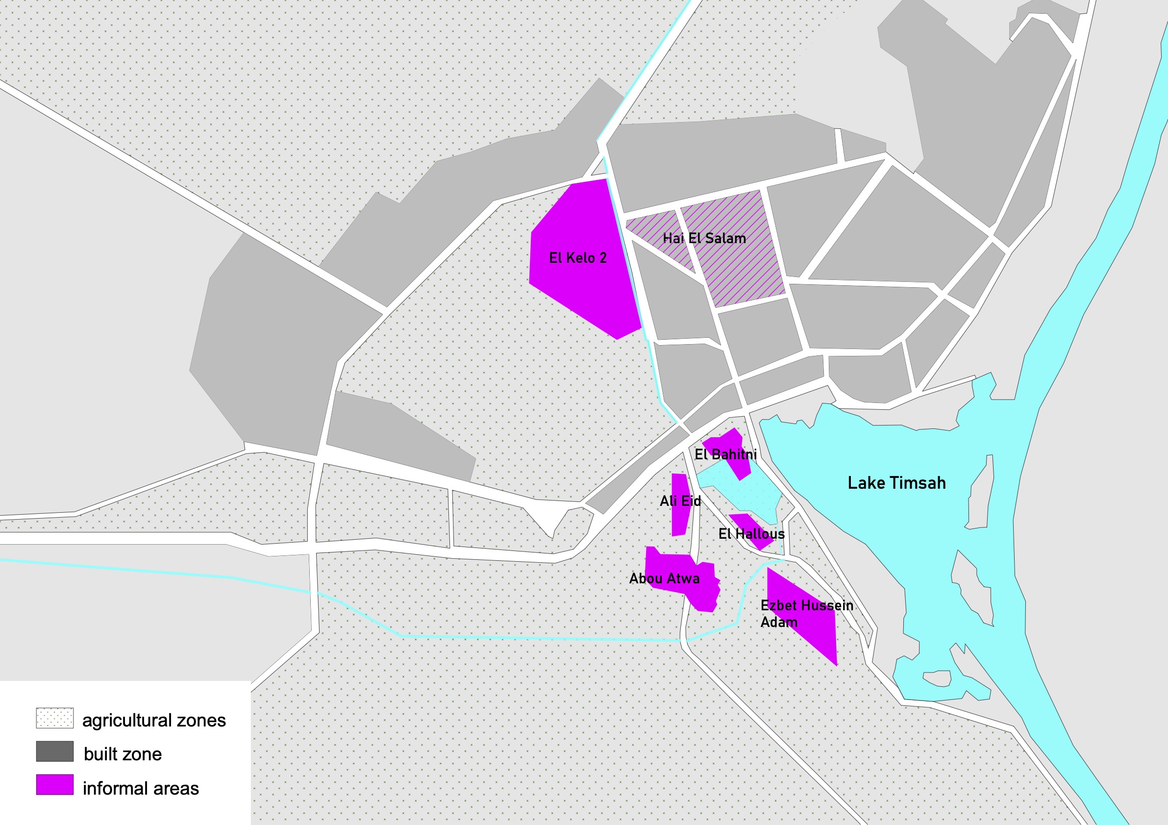
Semi-Private Spaces: Protected Spaces in a Growing City
by Clara Zuber